
By 1941, 11 RDF sites had been set up to monitor minefields covering approaches to docks and rivers around England. Three of these were situated in Essex and are still extant.
The RDF tower here at Harwich (TM 262 319) was built to cover the minefield between Beacon Hill and Landguard Fort. From this tower, bearing and range of the enemy vessel would be detected. This information was sent to two Extended Defence Officers (EXDO) towers, one at Beacon Hill, the other at Landguard.
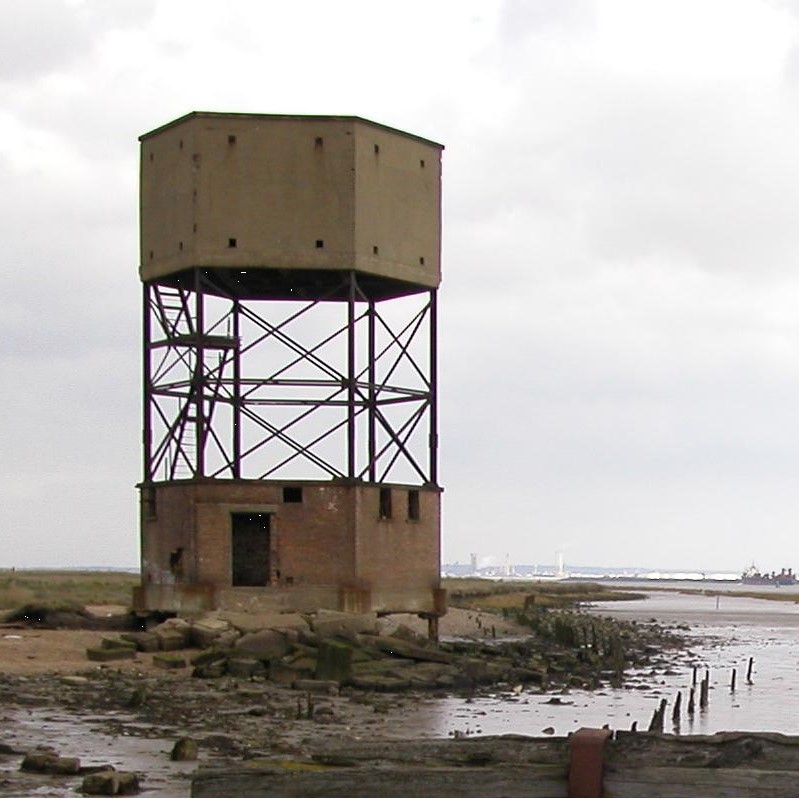
The RDF tower outside Coalhouse Fort, East Tilbury (TQ 689 762) covered the minefield laid between Coalhouse and Cliffe Fort, Kent. The Thames was a major target, being the approach to London and Docklands.
Unfortunately, this tower is at risk of collapse but can still be viewed externally on the foreshore.
Extended Defence Officers (EXDO) tower


Although the bearing and range was determined by the RDF tower, the plotting was done in the EXDO towers. The information was sent via a Magslip instrument, this avoided mistakes being made over the phone.
The bearing and range would then be plotted on a map of the minefield. Once the enemy vessels location was known, a group of four mines were selected and detonated electrically.
Throughout the UK there are several areas that were protected by minefields laid across rivers and estuaries. Each site would have been accompanied by EXDO towers, similar to those at Beacon Hill and Landguard.
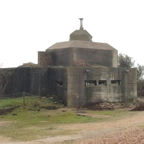
An excellent example can still be seen 4 miles due east of Burnham on Crouch, Essex (TR 01661 95809). Known locally as the Dengie Tower, it stands three floors high looking out over the River Crouch estuary.
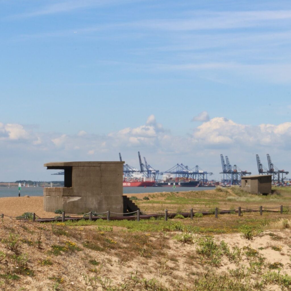
At Shellness Beach, 2 miles south east of Leysdown, Kent (TR 05277 67628), another example of an EXDO still stands on the beach, covering the minefield across the Swale. This is only a single storey structure with a square reinforced concrete lookout position on the roof.
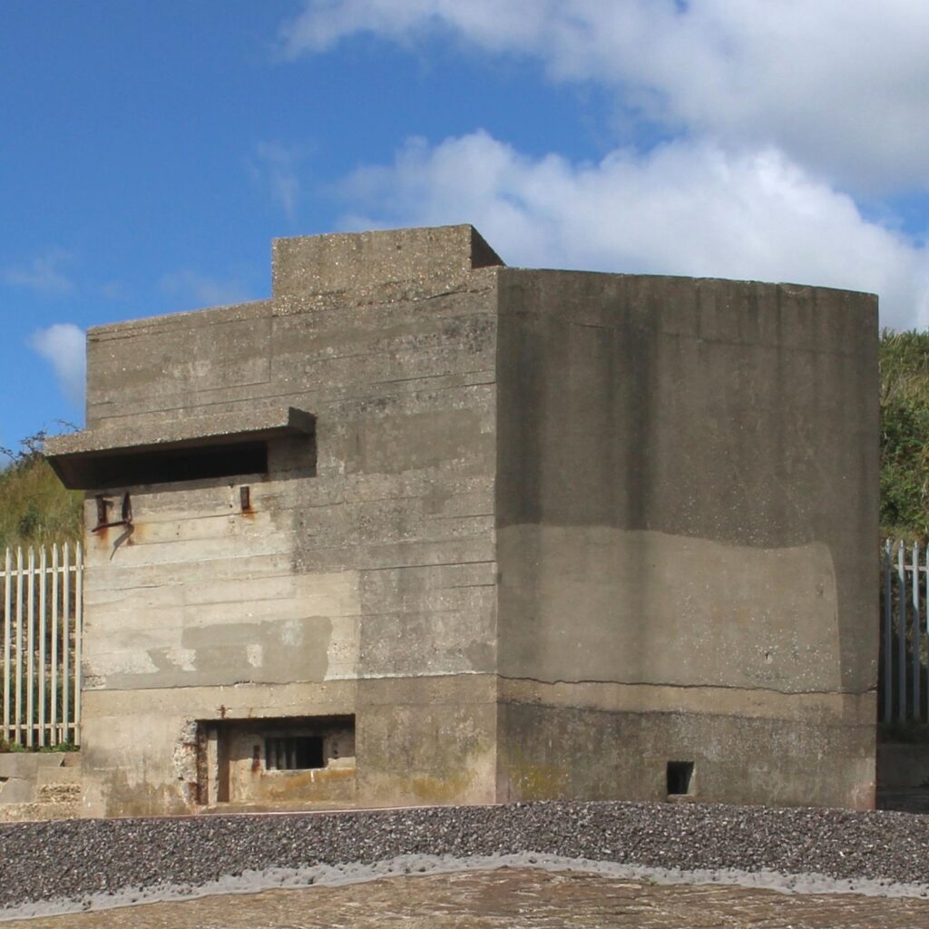
In East Tilbury, Essex a third EXDO tower remains in front of Coalhouse Fort (TQ 69058 76926). This tower is associated with the RDF tower nearby and would have covered the minefield across the Thames. This is a two storey example, with a concrete lookout similar to that at Shellness.
After the war, the EXDO tower outside Landguard Fort was reused to mount two Radar transceivers (below left). One can be seen above the lookout position, with the second mounted on top of the steel column. The ducting carried the cables between the transceivers and a temporary building installed next to the tower.
Searchlights
To enable the minefield to be monitored after dark, searchlights were set up on both sides of the river. At least 10 such emplacements, similar to the one pictured, were set up around Landguard Point and Beacon Hill.
Back Continue