The term RDF remained in use until c1943, when it became known by its more famous name – RADAR. This is an American word derived from Radio Detection And Ranging. RDF was developed only six miles away at Bawdsey, Suffolk.
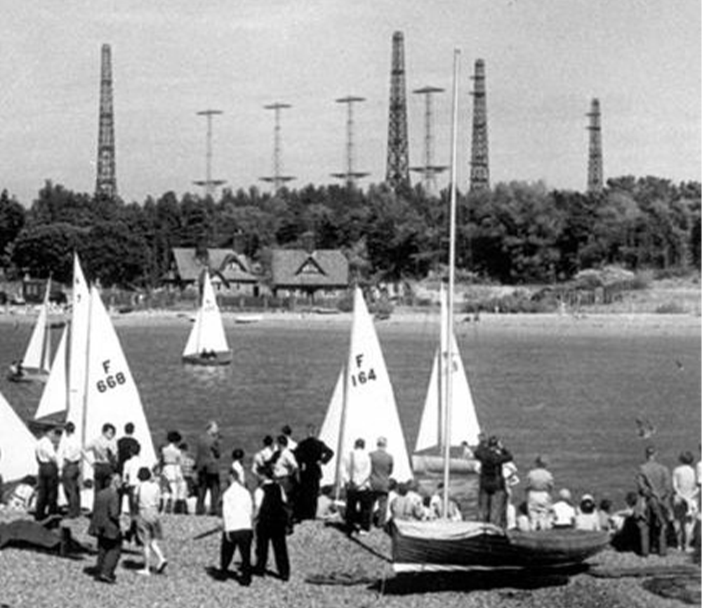
Between 1935 and the outbreak of war in 1939, a series of RDF stations were set up. These were known as Chain Home stations and there were originally 27 sites between Ventnor, Isle of Wight and Netherbutton, Orkney Islands. These were joined by the Chain Home Low stations after 1939. Aerial photos by [Greg Mann]
1.
Chain Home and Chain Home Low
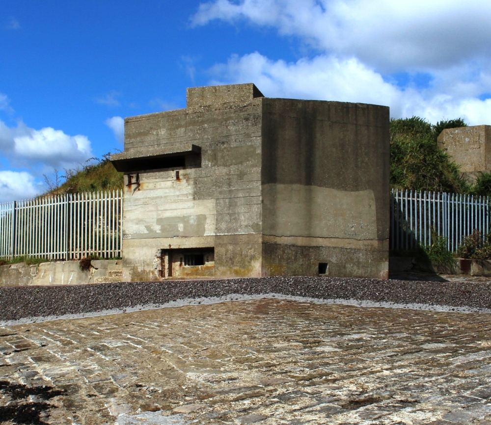
By the outbreak of World War II, both Chain Home (CH) and Chain Home Low (CHL) sites had been set out along the south and east coasts of the UK. CH was officially known as Air Ministry Experimental Station 1 (AMES 1) and CHL was designated AMES 2. These electronic early warning systems were a modern version of the concrete sound mirrors installed at various locations during the early 20th century. Excellent examples of these can still be seen at Greatstone, Kent.
2.
Minewatch RDF
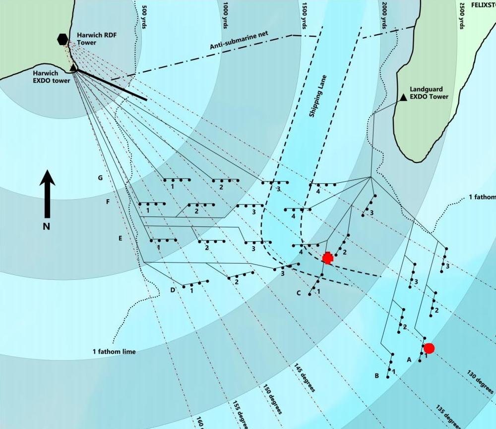
Following experiments with RDF, Robert Watson-Watt and John Coales finally designed a successful version of the Type 284 that could be used to identify targets at sea level. This system was designated Type 287 and was deployed at several sites around the UK in 1941. As the war progressed and the risk of invasion decreased, the minewatch RDF sites were stood down in December 1943.
3.
Type 287 introduction
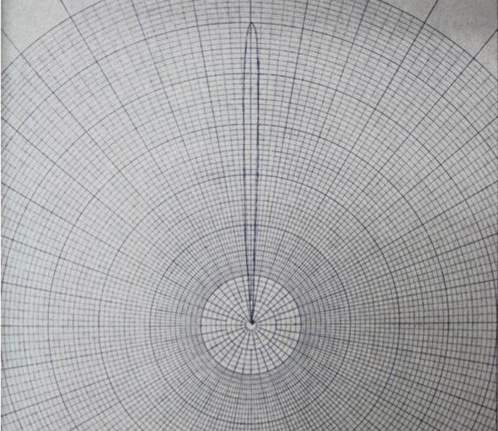
The Type 287 RDF set was designed to be used to identify targets at sea level and close range. By narrowing the ‘beam’ to 5 degrees, it was able to pinpoint targets entering the minefields set up across estuaries and rivers around the UK. Two further sets were installed in Essex to cover the Thames at Coalhouse Point, East Tilbury and Tollesbury, covering the River Blackwater near Maldon.
4.
Magslips and telephones
The RDF tower would have been connected to the two Extended Defence Officers (EXDO) towers by telephone, to ensure contact could be made when necessary. However, a system known as Magslip was used to convey range and bearing to both EXDO towers simultaneously. As this was an electronic system, it was considered a more reliable method to relay vital information correctly. The term magslip comes from the magnetic slip rings used to operate the device.
5.
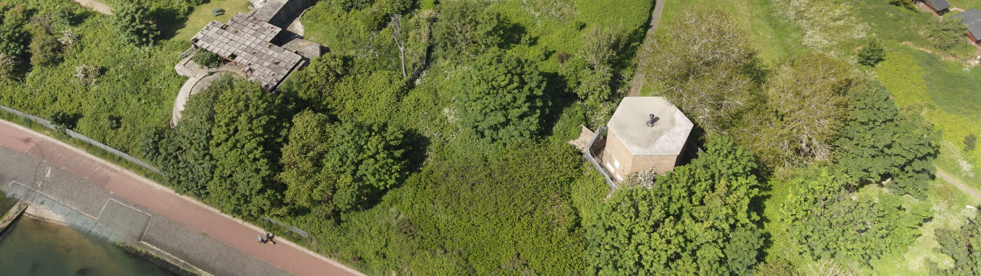
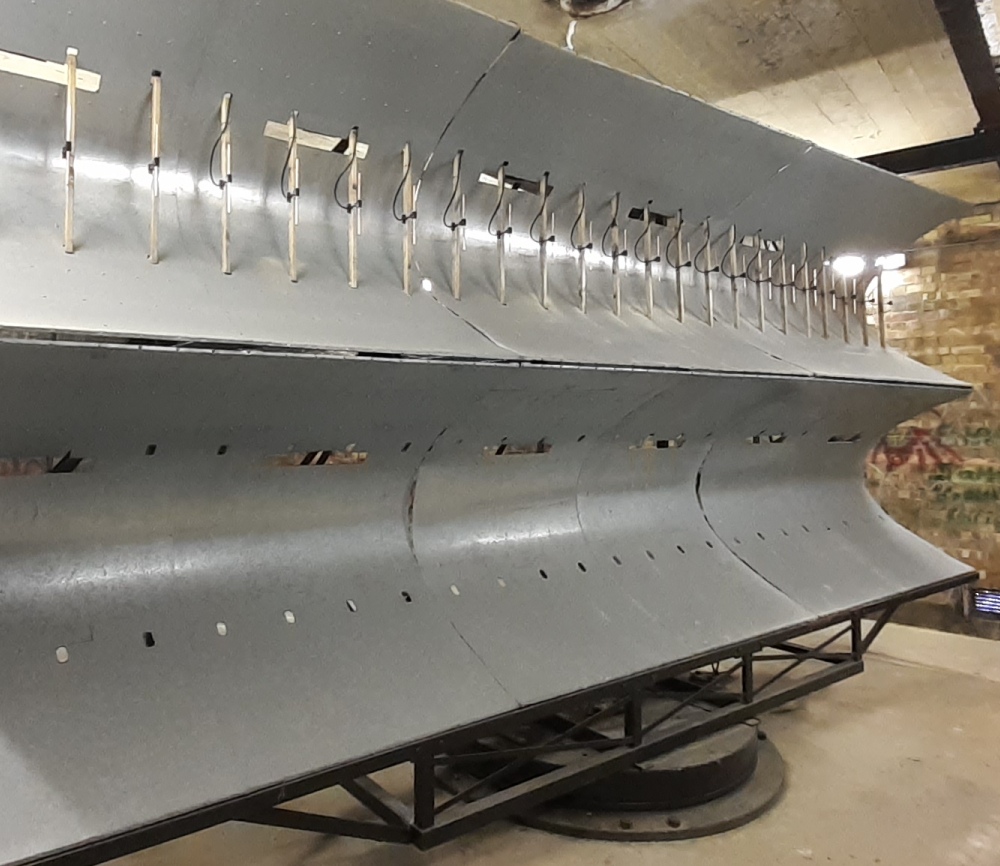
Type 287 array
The array housed in the RDF tower at Harwich is believed to be the only surviving example of it’s type in the world. Although successful, it was very short lived, as the risk of invasion subsided during 1943. The impressive array, 21 feet wide and 10 feet high (6.4m x 3m) still stands in the original position it did during the dark days of WWII.

6.
Historical figures
In 1915, Robert Watson-Watt used radio technology to provide advance warning to airmen and during the 1920s went on to lead the UK research establishment to make many advances using radio techniques, including the probing of the ionosphere and the detection of lightning at long distances. Through his lightning experiments, Watson-Watt became an expert on the use of radio direction finding before turning his inquiry to shortwave transmission.